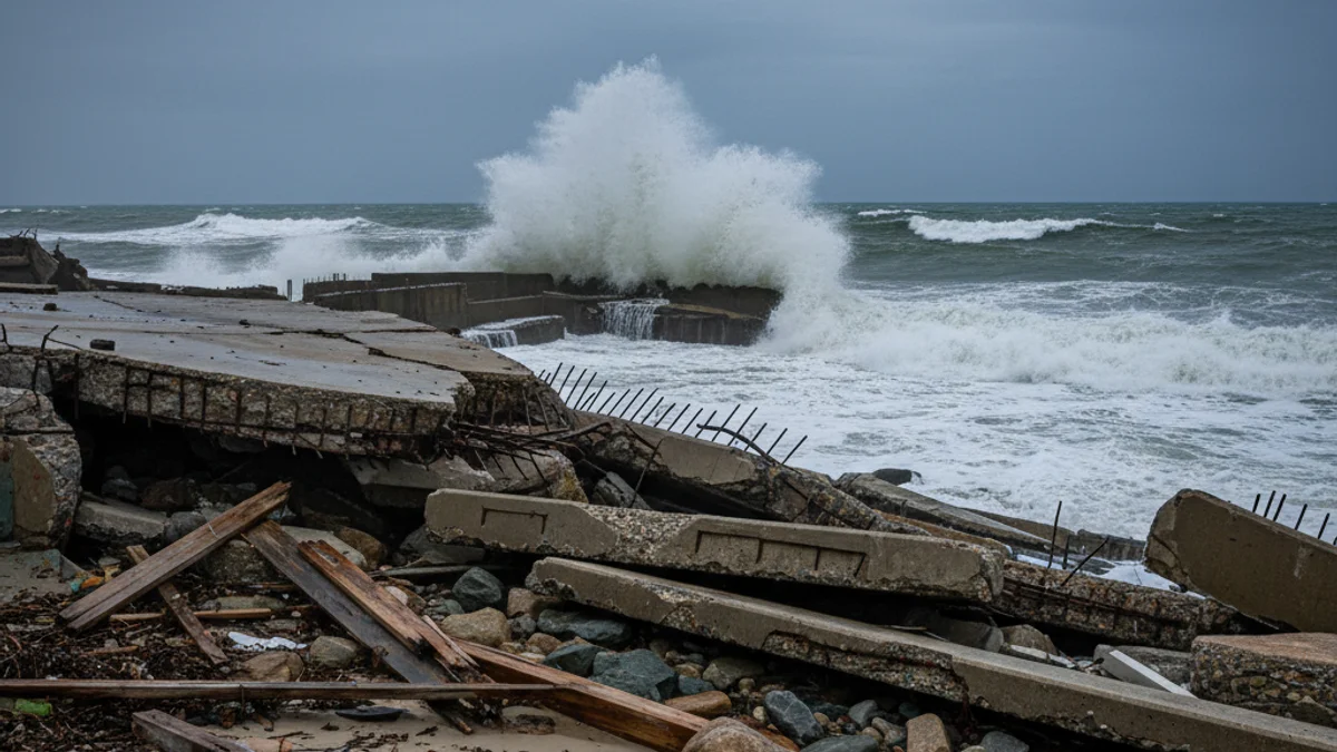
Following the passage of storm Harry, which caused river overflows and flooded streets, especially in the regions of Girona, the new Atlantic front maintains the alert. Harry's effects were notable on the coast, where waves over six meters destroyed part of the Badalona (Barcelonès) seafront promenade, rendering it unusable.
Storm Ingrid arrives this Thursday with overcast skies and precipitation in the central depression, the coast, and the pre-coastal areas of Girona and Barcelona. The wind will blow strongly, with Mistral gusts exceeding 80 km/h in Camp de Tarragona and Terres de l'Ebre, leading Meteocat to activate a yellow warning in the regions of Montsià, Baix Ebre, Baix Camp, and Alt Empordà.
Regarding snow, the level will initially be around 1,200 meters in the Pyrenees but will gradually drop. The meteorological division will be clear by Friday: while the coast will enjoy relative calm, the western third will experience generalized rainfall.
The coldest point will arrive early Saturday morning, when snowfall will reactivate in the west and the snow level will drop to 500 or 400 meters. This level is sufficient to cover many towns and cities in white, and snow could reach the northern regions of Barcelona and the interior of Girona, with maximum temperatures between 5 and 10ºC.