The departure of depression Oriana has allowed wind gusts to subside across much of Catalonia, although strong gusts were still recorded in the high Pyrenees during the early hours. According to Meteocat, an Atlantic front will bring increased cloud cover but minimal rain.
Snow levels are expected to rise from 1,600 to 1,800 meters. Snowfall will intensify again by evening with the arrival of a new cold front, particularly on the northern slopes. Despite the wintry conditions, temperatures are set to rise in most regions of Lleida.
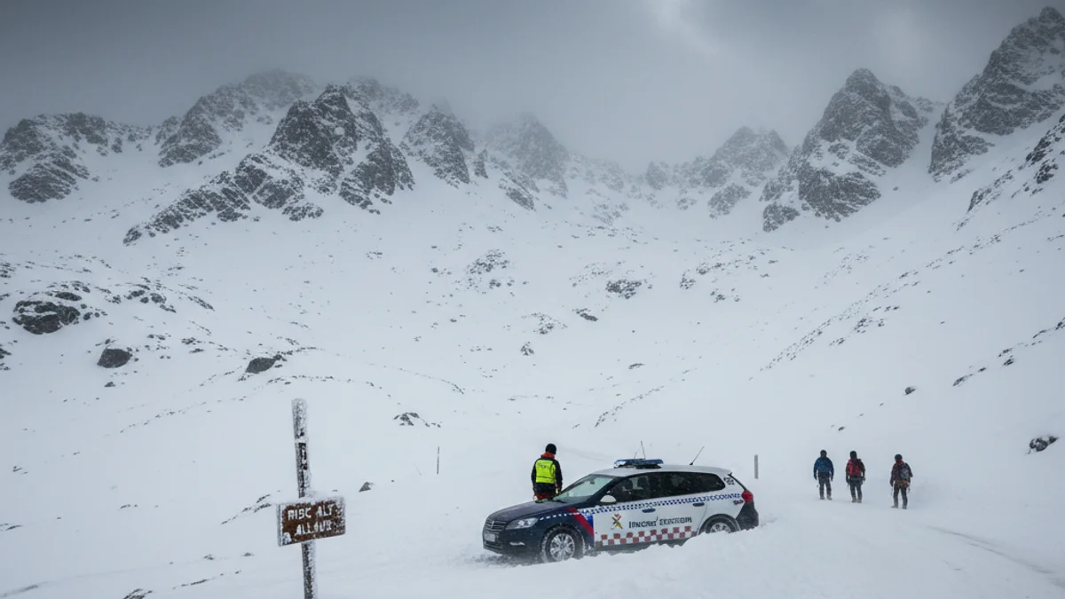
The most critical situation remains in the high mountains. The avalanche danger is rated 4 out of 5 in Aran and northern Pallars Sobirà, while the Ribagorçana and Pallaresa basins remain at a marked level 3 risk.