Following the passage of storms Joseph and Kristin, the Iberian Peninsula remains under the impact of a train of low-pressure systems. Aemet has warned that these new Atlantic fronts will trigger a new wave of maritime storms in the Mediterranean, Cantabrian Sea, and Galician Atlantic coast, accompanied by heavy rainfall.
In Catalonia, Meteocat has activated wind warnings between Friday and Sunday. Gusts could exceed 70 km/h in areas such as Baix Llobregat, Penedès, Anoia, Tarragonès, and Baix Camp. Authorities urge extreme caution due to the risk of strong waves and high winds.
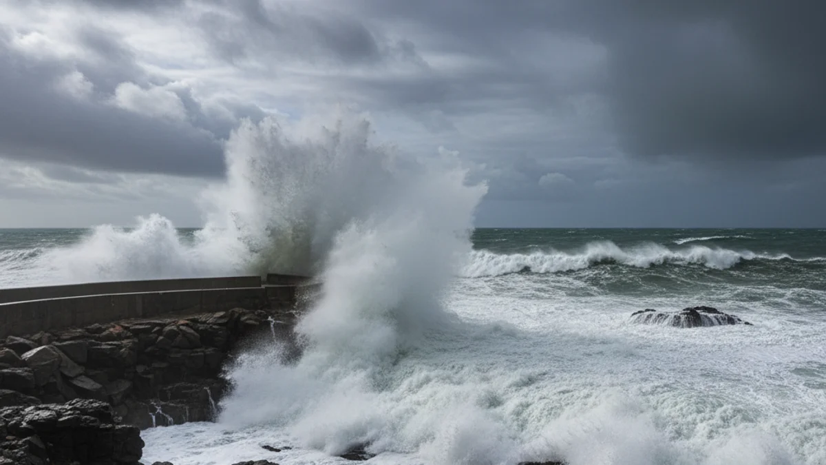
The train of storms approaching the Iberian Peninsula will also lead to hurricane-force winds in various parts of the territory which, in some cases, could even exceed 100 km/h.
Meteorological models indicate that winds will be particularly intense on the coast and pre-coastal areas of Tarragona, where Aemet forecasts gusts that could reach 100 km/h. Furthermore, waves are expected to exceed six meters in height at points along the Mediterranean coast, including Empordà.
This situation will also bring a new round of snowfall between Friday and Saturday in high and mountainous areas, mainly in the northern peninsula, although no significant rain accumulation is expected for most of the Peninsula and the Balearic Islands yet.