The storm affecting Catalonia since Friday night is reactivated with the arrival of a 'llevantada' (southeasterly storm surge), which will intensify rainfall across the eastern half of the territory, the coast, and the pre-coastal areas. So far, areas like the Pyrenees and Tarragona have already registered between 70 and 100 liters, but forecasts indicate that 200 liters could be exceeded in northeastern Catalonia.
“"A new episode begins this afternoon: a 'llevantada' that will last Monday and Tuesday, with maritime winds driving humidity and precipitation."
The adverse weather situation will worsen at the beginning of the week, with the possibility of accumulating more than 150 and 200 liters in the northeast. Furthermore, both the coast and pre-coastal areas will receive large amounts of water, and Tarragona and the Terres de l'Ebre will also exceed 100 liters. Snowfall will intensify, with accumulations of 40 centimeters starting at 1,400 meters and more than 80 centimeters above 2,000 meters.
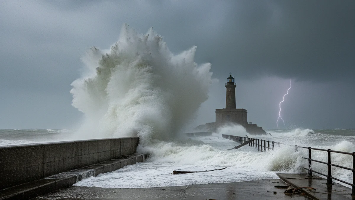
Starting Monday, a depression in the Mediterranean will cause a first-category maritime storm, which could be comparable to 70% of the Gloria storm. Waves over 2 meters are expected along the entire Catalan coast, with the worst situation in the Costa Brava and the Central Coast, where they could exceed 4 meters in height.
“"We may issue a mass warning if these meteorological effects are confirmed and the danger level is 5 or 6."
Given the severity of the episode, Protecció Civil maintains the Inuncat and Neucat plans on alert. The Catalan body warns of a marked and increasing avalanche risk and urges caution on high mountain roads. Monitoring is also underway for the reservoirs of Siurana, Pyrenees, and Ter, and there is a risk of overflows and rock or tree landslides due to saturated ground.